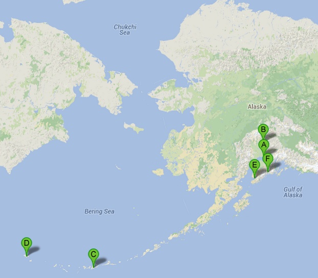
The following images come from some of the dozens that I snapped during a visit to Alaska in June 2000. They don’t do justice to the sense of scale that Alaskan lands convey, but should at least offer hints at some of the things that I found to be of interest while I was there. The trip covered three primary areas: Attu Island, the western-most island in the Aleutian chain; Homer and Kachemak Bay on the Kenai peninsula; and Seward and the Kenai Fjords, on the other side of the Kenai. Before getting to Attu there was an unplanned side adventure that took me to Talkeetna on the way to Denali. Many of these notes are being written during the summer of 2013, so the arts of time and memory have doubtless been at play.
The photos were taken with a 1.3 megapixel Olympus D-450 Zoom and represent the limitations of both my experience and the fact that I only had an 8MB and 16MB SmartMedia card to capture a 3 week trip. No laptop at the time either, so I recall squinting at the little display at night trying to edit the collection. Clearly photography was not a priority at that time. Thankfully, times and my equipment list have changed!
An overview of the trip 
Because travel to Attu requires a great deal of specialized preparation, I am very grateful to Larry Balch’s Attour for making my visit possible. Sadly, due mainly to the closure of the USCG’s LORAN station on Attu, the trips Attour ran are now no longer feasible. Here is an earlier trip report from Attour to give some additional perspective and flavor of what these trips were like. The Aleutian’s Homepage offers a large amount of historical and current information about the Aleutian islands, including an account by Russ Marvin of this same June 2000 trip. The site includes a wide variety of WWII-related content.
First day: Talkeetna and Denali
Next: A short week on Attu
Next: Homer and Kachemak Bay
Next: Kenai Fjords and Exit glacier near Seward
